Day Trip – Sierra de la Laguna – Access from KM53
May 20, 2009 by jim.pickell
Filed under Activities
One of the most unerappreciated activities near Todos Santos is the opportunity to hike in the Sierra de la Laguna mountain range on the Baja California Peninsula of Mexico., one of UNESCO’s global biosphere reserves . It lies at the southern end of the peninsula in the state of Baja California Sur, and is the southernmost range of the Peninsular Ranges. What’s perhaps most specatular is that within miles one can travel from sea level to over 1 mile in altitude, totally transforming the landcape and climate until you’re walking in an oak forest on a lake bed that you never imagined existed.
The southern tip of the peninsula, including the Sierra de la Laguna, was formerly an island, and it has a distinctive flora and fauna, with many affinities to southern Mexico. The Sierra is home to many endemic species and subspecies. The dry San Lucan xeric scrub extends from the coast to 250 meters elevation. The Sierra de la Laguna dry forests occupy lower portion of the range, from 250 to 800 meters elevation. Above 800 meters elevation, the dry forests transition to the Sierra de la Laguna pine-oak forests. The composition of the pine–oak forests varies with elevation; oak woodlands predominate from 800 to 1200 meters elevation, with oak-pine woodlands between 1200 and 1600 meters elevation, transitioning to pine-oak forests above 1600 meters elevation. The predominant pine is a local subspecies of Mexican Pinyon, Pinus cembroides subsp. lagunae.
The forests are exploited commercially for timber, and cattle-raising is common in the oak woodland and dry forest zones. “This semi arid to temperate subhumid climate area represents highly important and contrasted ecosystems, including arid zones, matorrales, low deciduous forest type, evergreen oak: Quercus devia (“encino”) woods, pine-evergreen oak mix woods and oases with palms and “guerivos” situated throughout the gallery forest following the long river basins.” The Biosphere reserve was established by a Mexican presidential decree of 6 June 1994, which designated a core area and buffer zones. The core area is centered on the higher-elevation oak-pine forests, while the transition area includes the communities of Todos Santos, El Pescadero, El Triunfo, San Antonio, San Bartolo, Buena Vista, Los Barriles, Las Cuevas, Santiago and Miraflores.
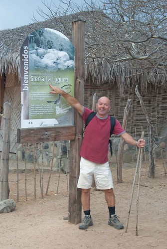
There are many different ways to access the Sierra de la Laguna mountains. An easy introduction is to head south a few kilometers from Todos Santos. Turn left around km53, across from a stone fence. Head about 27 kilometers towards the mountains. You will pass a lookout tower and see signs for a biosphere and reserve. Park at the gate and start your hike. Your car is typically not at risk here as there are rangers patrolling.
Advice – start very early (e.g., 7am), bring water and plenty of sunscreen. I would suggest 1 – 1.5 hours up and a little less back. If you like this one, you’re ready for the overnight trip. Enjoy!
[flickr album=72157618547128110 num=10 size=Small]
Possibly Related Posts:
- Event – Todos Santos International Guitar Festival – November 27 – 29, 2015
- Event – Todos Santos Music Festival – January 14 – 16, 20 – 23, 2016
- Event – 4th Annual Gastrovino Food and Wine Festival – April 24 – 26, 2015
- Event – 12th Annual Todos Santos Film Festival – March 12-22, 2015
- Activities Index


